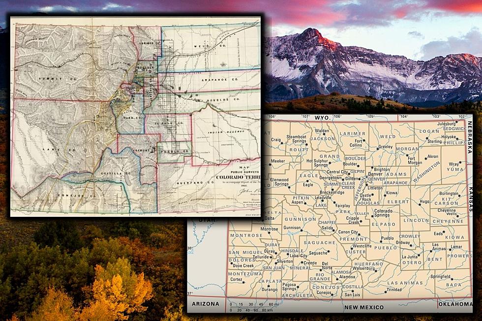
What if Colorado’s County Maps Still Look Like They Did in 1866?
Today we have the time machine pointed at the year 1866.
During this year, the Colorado county map looked far different than it does today. Did you know that Summit county used to go all the way to Utah? Did you know the Grand Junction area used to be part of a gigantic version of Lake County?
Thanks to mapgeeks.org, we have accessed some of Colorado's oldest county maps and they are fascinating.
1866 Map of Colorado County Formations

I had no idea Summit and Lake counties used to be so big. The map even shows the location of Indian lands on the Eastern Colorado plains.
Mitchell’s 1880 State, County, and Township Map of Colorado

- Map Date: 1880 (Entered 1879)
- Map Locations: Colorado
- Map Cartographer: Samuel Augustus Mitchell Jr. (1827-1901)
By 1880, Colorado was getting more organized. I wonder what it took for Summit and Lake counties to give up all that land? As we will see in the gallery below, Colorado counties gain and exchange land with one another a lot over the years.
1895 State Map of Colorado

- Map Date: 1880 (Entered 1879)
- Map Locations: Colorado
- Map Cartographer: Samuel Augustus Mitchell Jr. (1827-1901)
By 1895, We see Colorado looking a lot more like it does now. Much of the action after 1900 surrounds the growth and development of the city and county of Denver. Have you ever looked at Denver County? I don't even know what you call that shape.
By the time we get into the 20th century, most of the county map changes will be in and around Denver county with a few other adjustments here and there.
Colorado State Map with County Seats

Here we can see the Colorado we are more familiar with today with each of the county seats included. Incredible to see the difference between the 1866 map and something much closer to today. Sorry, Lake and Summit Counties. Titans you once were.
Below we will scroll through all the available variations of the Colorado County maps that we could get our hands-on. Walk through the changes and see what happened year by year as the state developed from the time of 1850 to today.
See How Colorado's County Maps Evolved from 1850 to Today
MORE COLORADO: All The Colorado Ski Resorts Listed By County
MORE: 25 Fun Facts About Colorado Sports Teams
More From Townsquare Fort Collins