THURSDAY UPDATE: NWS Weekend Travel Impacts for Fort Collins Area
This week's snowstorm could drop multiple feet of snow on the Fort Collins area. The National Weather Service has updated travel and infrastructure impacts.
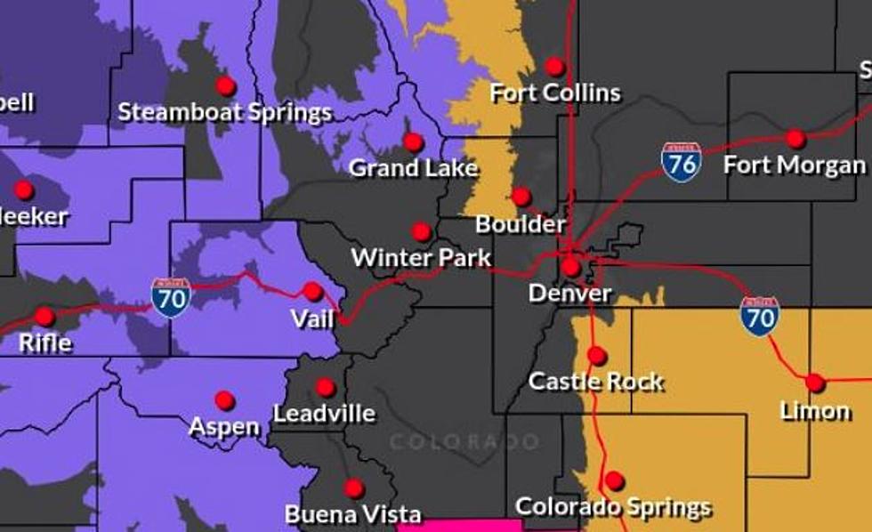
As of Thursday morning, the latest update shows the spring snowstorm moving into the Front Range area on Friday, which is later than some previous reports. Precipitation is still expected on Thursday afternoon and evening, with a mix of rain and snow very likely. The National Weather Service reports that less than half an inch of accumulation is possible in the Fort Collins area both Thursday and Friday.
According to the National Weather Service's Twitter, 'impacts for travel and infrastructure' during the 'potentially significant storm' have shifted to Saturday.
Unlike earlier predictions, the Fort Collins area is expected to have 'little/no' impacts on Thursday and Friday. Saturday and Sunday remain 'significant.' Monday will have 'limited' impacts, and the National Weather Service says it will be the day we 'dig out.'
Earlier this week, KDVR's Matt Makens said that the 'brunt of the storm expected to hit on Saturday,' The storm has the potential to drop over two feet of snow on the Front Range, but it's still uncertain how much we will get.
5 Most Dangerous Intersections in Fort Collins
More From Townsquare Fort Collins


